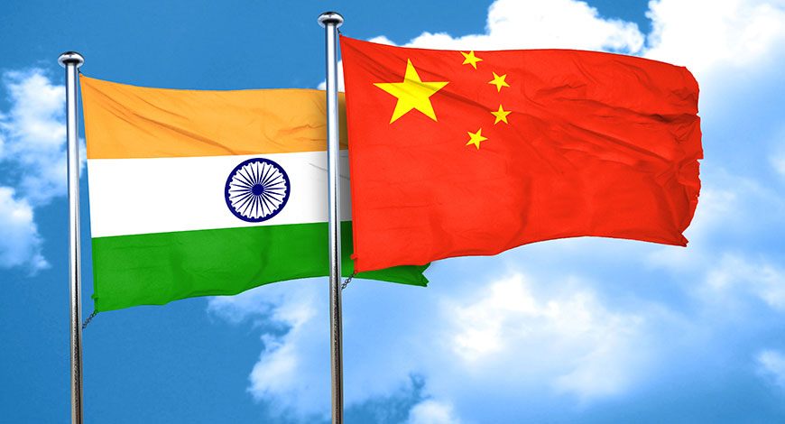
China and India are the two major powers in Asia and among the most important countries in the world. Their relationships are complex and difficult. Although the armed forces of the two nations have clashed in brief skirmishes, albeit very violent, on the mountainous borders of the Himalayas, they are both part of the BRICS (Brazil, Russia, India, China, South Africa), a very important economic and political bloc, and both have large economic contacts (India’s exports to China are about US $21.25 billion, and its imports from China are about US $94.16 billion). But at the same time, they are involved in a harsh rivalry and game of influences, which in an important part takes place around the geostrategic space of the Indian Ocean (and surrounding waters and countries).
The Indian Ocean is a region of great strategic importance due to the resources it harbors, the trade routes that pass through it, and because it contains some of the most important choke points in the world.
The Indian Ocean oceanic region is essential for the global maritime balance, because it contains some of the most relevant maritime choke points in the world. Specifically, these four strategic crossing points are: 1) Bab el-Mandeb, which connects the Red Sea with the Gulf of Aden; 2) the Strait of Malacca, one of the most important shipping routes in the world; 3) the Strait of Hormuz, the only passage from the Persian Gulf to the ocean; and 4) the Mozambique Channel, an important trade route for transit between the Cape of Good Hope, the Middle East and Asia.
Specifically, for China and India, this is a region of vital importance to their interests; which has led them to develop strategies to establish their presence in this geographical area. As a consequence, this has triggered (and worsened) a geostrategic competition between both states to establish naval bases, consolidate alliances with coastal countries to secure their areas of influence, and develop a maritime force that can confront the counterpart. For this reason, the Indian Ocean appears to be one of the main areas in the rivalry between India and China to establish their particular superiority in the region.
Geographically speaking, the Indian Ocean is the third largest in the world, stretching from the east coast of Africa to the west coast of Australia. This region has grown in strategic importance; and one of the reasons is the growing competition between India and China to establish their leadership in this area. The Indian Ocean region is vital for the international maritime trade that passes through it—the supply of resources, such as oil, the choke points it contains, and the maritime lines of communication present on it.
In general terms, India and China have two different strategies and approaches, which have an inherent element of friction. While China seeks to protect its New Silk Road and its maritime lines of communication through a strategy labeled as the “String of Pearls” (a network of friendly states which allow the establishment of economic and military ties); India intends to establish itself as a regional leader and security provider in this region. These two strategies have collided in the region.
The geostrategic importance of the Indian Ocean has grown in intensity due to the economic growth of Asian countries, especially China, coupled with the rise of India as one of the most important littoral states in the region, and marked by a greater presence of the US in the Asia-Pacific to contain China. For India and China this region is vital. For India, foreign trade through its maritime lines of communication in the region represented 43.4% of its GDP in 2018. In addition, India depends on this area for 80% of its oil supply, being the third largest consumer of oil in the world. For China, the region is even more essential, as virtually all its maritime trade passes through it. Therefore, the Indian Ocean is a vital region for China’s interests. This area is becoming the epicenter of the geostrategic rivalry between India, now the sixth largest economy in the world, and India.
In Beijing, the growing Indian presence raises concern, since this region is of vital importance for their trade, the supply of resources, and their geopolitical ambitions.
After decades of invasions and interference by European powers throughout the 19th and 20th centuries, known as the “century of humiliation,” China is rising as a new world power in the economic and military fields. According to the World Bank, it is the second largest economy in the world, in terms of GDP, only behind the US (although the structural fragilities of its economy carry the risk of blowing up and slowing growth substantially, and thus causing it to fall from that position).
Spurred on by strong nationalism under the leadership of Xi Jinping, China is using its economic growth to return to “Greater China,” a concept related to the geography of the country’s imagination, under which Beijing would reclaim the territories usurped by the colonial powers during the 19th century and implement the setting up of the Heartland theory. The Heartland theory, elaborated by the geographer John Mackinder (1861-1947), establishes that whoever controls the area between Central Asia, Central Russia and Siberia has a privileged position in regards to the domination of the rest of Europe and Asia, and, potentially, world dominance.
But, as a rising revisionist power seeking to establish a new position in the international order, China needs to secure the supply of energy resources.
The control of the maritime lines of communication is pivotal to maintain international trade and retain a global role. This imperative has made Beijing to focus its attention in recent years on the oceans, and increase its maritime defensive capabilities, since the establishment of the PRC, focused on coastal defence. As the South China Sea, adjacent to its territory, imposes certain limitations due to territorial disputes involving several states and US presence, China has (partially) re-oriented its sights on the Indian Ocean to ensure its geopolitical interests.
As mentioned above, China’s interests in this region are to ensure the supply of resources, maintain trade routes and develop its Maritime Silk Road, with which it intends to challenge Western dominance in international markets and in the Indo-Pacific region. Therefore, China’s main objective in this area is to protect its maritime lines of communication; and for this, Beijing has developed a strategy which has been called by several analysts as the “String of Pearls.” Under this strategy, China seeks to increase its military, economic and diplomatic influence in the region through the development of infrastructures and the establishment of alliances with the coastal countries of the Indian Ocean.
In the Horn of Africa, in 2016, China established its first military base outside its territory, in Djibouti. In this way, it aims to increase its presence in an area of vital strategic importance, since the Bab el-Mandeb Strait is located there at the entrance to the Red Sea, and it is the route that connects Asia with Europe through the Suez Canal. In addition, China has made large investments in African countries of the Indian Ocean littoral, particularly Kenya and South Africa. This allow it greater influence in a geographical area where the Mozambique Channel runs, which is one of the strategic choke points in the Indian Ocean region.
Another vital component of the Chinese strategy is the construction of the Gwadar port in Pakistan, in which China has invested heavily, as it is part of the Sino-Pakistani Economic Corridor (CPEC). Located in a region of great strategic value between the Middle East, Pakistan, and Central Asia, the port directly connects Chinese territory with the Indian Ocean through highways and railways.
The relations between Pakistan and China are however subject to many turbulences, and the complicated political life of Islamabad is an element of incertitude for Beijing’s strategy, together with the open file of Afghanistan, which together represent a pending and unresolved threat to the full development of CPEC.
China has also established economic ties with the Maldives, a country that joined the New Silk Road initiative in 2014. These islands represent a major focus of geostrategic competition between India and China. In 2018, the most favorable candidate for Indian interests won the presidential elections. However, considering that Chinese investments represent 80% of the Maldives’ debt, it is very likely that Beijing will continue to maintain its influence. Beijing also maintains a heavy presence in Sri Lanka. In this country it has acquired the port of Hambantota. This location not only serves to control freighters heading towards China, but also allows it to monitor India’s movements in the area. In addition, it can keep a military force in reserve, in case of conflict.
The recent crisis (now political, the consequence of insane economic management) in Sri Lanka is closely monitored by Beijing, being worried to lose an important element of the “String of Pearls.”
China is also present in Chittagong, the largest port in Bangladesh, where it has invested in facilities and warehouses for cargo ships, and has taken part in the framework for the improvement of the national network of communication infrastructures, and the construction of the Karnaphuli tunnel (a.k.a. “Bangabandhu Sheikh Mujibur Rahman Tunnel,” an under-construction, underwater expressway tunnel in the port city of Chattogram, under the Karnaphuli river).
Chinese expansion is also going on in Myanmar, specifically in the coastal city of Kyaukpyu on the Bay of Bengal, which appears to be one of the critical sub-areas of the Indian Ocean. There, since 2016, China has been given access by the military government to develop a special economic zone and build a port.
By establishing ground connections between these premises and Chinese territory, Beijing can reduce its dependence on the Strait of Malacca for gas and oil imports. Through the same, Beijing seeks to control the ships that pass through the Bay of Bengal towards the Strait of Malacca.
It is also reported that China is looking to develop surveillance operations near the Cocos/Keeling Islands (Australian federal territory), and/or Indonesia (another willing member of BRICS). The Cocos/Keeling Islands have been eyed for years by the US as possible site of strategic surveillance, focused on monitoring air and naval activities of Beijing in the area. Given the enhanced security ties between Washington and Canberra, this option looks very realistic in the midterm. In the recent past, the possibility of this appeared feasible from the perspective of the withdrawal of US presence from the Chagos Islands, a British territory in the Indian Ocean, due to the sovereignty claims of the Maldives. Now that this option seems over, and the growing military activity of China in the region keeps Cocos/Keeling as an important outpost of the strategy of controlling/countering Beijing with the reinforcement of the surveillance capabilities.
Finally, the “String of Pearls” extends through the South China Sea to the very coast of the Asian country. Here, the island of Hainan constitutes a Chinese military base and the first element of this economic and security architecture of Beijing’s strategy.
Due to its geographical position in the Rimland, India represents an important strategic pivot, critical for the penetration of the Middle East and China towards the sea.
The Rimland is a concept championed by Nicholas John Spykman (1898-1943), professor of international relations at Yale University. To him geopolitics is the planning of the security policy of a country in terms of its geographical factors. He described the maritime fringe of a country or continent; the densely populated western, southern, and eastern edges of the Eurasian continent. He criticized Mackinder theory for over evaluating the Heartland as being of immense strategic importance due to its vast size, central geographical location, and supremacy of land power rather than sea power. He assumed that the Heartland would not be a potential hub of Europe, because: a) Western Russia was then an agrarian society; b) Bases of industrialization were found to the west of the Ural Mountains; c) This area is ringed to the north, east, south, and south-west by some of the greater obstacles to transportation (ice and freezing temperature, lowering mountains etc.). There has never really been a simple land power–sea power opposition. Spykman thought that the Rimland, the strip of coastal land that encircles Eurasia, is more important than the central Asian zone (the so-called Heartland) for the control of the Eurasian continent. Spykman’s vision is at the base of the “containment politics” put into effect by the US in its relation/position to the USSR during the post-WWII era. Thus, “Heartland” appeared to him to be less relevant in comparison to “Rimland.”
While history links India to Central Asia, geography leads New Delhi to the Indian Ocean. It is the largest littoral state in this region, and is located in a strategic position between the maritime routes that join the Straits of Malacca, Hormuz and Bab el-Mandeb; three of the most important choke points in the world. India perceives itself as the most important state in the Indian Ocean, thus destined to be the natural leader in the region. India perceives these waters as part of its territory and its maritime border; that is, “India’s Ocean” rather than the Indian Ocean.
Because of this visionary geography, India is suspicious of the presence of external actors in the region, particularly China, and its position can be described as its own Monroe Doctrine, in which it assumes that the presence of external actors is illegitimate and that littoral states must trust India for their security and protection. [The Monroe Doctrine was a US foreign policy position, launched by the US President James Monroe in 1823 that opposed European colonialism in the Western Hemisphere. It held that any intervention in the political affairs of the Americas by foreign powers was a potentially hostile act against the US. The doctrine was central to Washington foreign policy for much of the 19th and early 20th Centuries.] Therefore, India aspires to become the regional leader that guarantees the security of the littoral states.
In pursuit of this goal, India has undertaken a series of internal and external actions to strengthen its position in the Indian Ocean region. Internally, New Delhi has major ports and 200 minor ports on its territory. In addition, it has initiated a plan called “Sagarmala,” which is expected to double the number of main ports in the country. Also, it should be noted that India is the third country with the highest military spending in the world (72.9 USD billion in 2020).
The Sagarmala Programme (garland of the sea in Hindi) is an initiative by India to enhance the performance of the country’s logistics sector. The programme envisages unlocking the potential of waterways and the coastline. It entails investing US $120 billion to set up new mega ports, modernizing India’s existing ports, developing of 14 CEZs (Coastal Economic Zones) and CEU (Coastal Economic Units), enhancing port connectivity via road, rail, multi-modal logistics parks, pipelines & waterways and promoting coastal community development, with the aim of boosting merchandise exports by US $110 billion and generating around 10 million direct and indirect jobs. The Sagarmala Programme is the flagship programme of the Ministry of Shipping, launched in 2015, to promote port-led development in the country by exploiting India’s 7,517 km long coastline, 14,500 km of potentially navigable waterways and its strategic location on key international maritime trade routes. Sagarmala aims to modernize India’s ports, so that port-led development can be increased and coastlines can be developed to contribute to India’s growth. It also aims at transforming the existing ports into modern world-class ports and integrating the development of the ports, the industrial clusters and hinterland and efficient evacuation systems through road, rail, inland and coastal waterways, resulting in ports becoming the drivers of economic activity in coastal areas.
India’s diplomatic strategy is focused on improving its relations with countries like the Maldives and Sri Lanka and prevent them from falling into China’s sphere of influence. As for the concrete steps it has taken, India has established an alliance with Iran, a country which it has helped to develop the first phase of the construction of the Chabahar port, which is of great importance to India, given its location near the Strait of Hormuz. This way, India will not only be present in one of the most important maritime routes in the region, but it will be able to control the presence of Chinese ships in the area, being only 72 kilometers from the above-mentioned port of Gwadar, which is managed by Beijing.
With similar objectives, India has acquired the port of Duqm in Oman, which can provide logistical support to its military ships in the area, in addition to giving it access to the Gulf of Aden and the Red Sea. All this also allows New Delhi to strengthen its own maritime lines of communication.
India has also established ties with Indonesia. Both countries have reached an agreement for India to acquire the port of Sabang, which is of vital importance due to its proximity to the Strait of Malacca. Indonesia has stated that it does not want to join China’s New Silk Road, so it can become an important ally for India. Likewise, New Delhi has extended its influence on the African coast of the Indian Ocean. Together with Japan, it launched the AAGC (Asia-Africa Growth Corridor) initiative in 2017 to promote infrastructure development and ties between African countries, India, and Japan.
On the defensive front, India’s presence in the region allows it to secure its investments and combat piracy near the strategic Bab el-Mandeb strait. Finally, India has established its presence in the Seychelles and in Madagascar. In the first, an agreement was signed in 2015 whereby India would help create a coast guard to support the fight against piracy and maritime trafficking. In the second, it installed a radar to serve as a preventive system and early recognition of maritime traffic in a region of great importance, since the Mozambique Channel runs through it, which is one of the most important choke points in the Indian Ocean.
As mentioned already, given that both strategies have collided in the same geographical space, given the rising geostrategic competition between the two countries to establish their dominance. To understand this better, it is pivotal to ask the question of how India and China perceive each other.
From India’s perspective, China’s actions, specifically the String of Pearls, cause New Delhi to be concerned that Beijing is trying to encircle it.
herefore, India perceives that the Chinese presence in the Indian Ocean is not only to pursue its economic interests but is also intended to leave India unable to extend its influence in the region. This is exacerbated by the growth of ties between China and Pakistan. Considering its great rivalry with Islamabad, for India these alliances represent a major threat, because, among others, with the help of China, Pakistan is modernizing its naval force, though not at a level to be a serious threat for the Indian Navy, clearly more powerful.
In short, there is a perception that China seeks to establish its maritime power in the Indian Ocean to become a hegemonic actor in Asia; and this to the detriment of India’s interests.
On the other hand, China does not share India’s image of itself as a leader in the region. For Beijing, this image of a regional leader is not reflected in the status of power that it has, which is considered below other nations with a presence in Asia, such as Russia and Japan. It could be argued that while India sees China as an important threat, Beijing’s perception of New Delhi, though it is to be monitored and countered to keep it from growing, is lower.
Furthermore, China alleges that India and other littoral states have a misperception of the strategy referred to as the String of Pearls. Beijing states that its only intention is to protect its maritime lines of communication and trade routes, thus repeating the same explanation that it has used with all the other countries in the world that look at its activities with suspicion.
It is necessary to point out that China is very dependent on these waters for the passage of resources, due to what is called the “Malacca dilemma.” [“Malacca Dilemma” is a term coined in 2003, by the then Chinese President Hu Jintao. It is a term that represents the potential factors that could hinder China’s economic development through choking oil imports. China is the world’s largest importer of oil, accounting for 80 percent of the total oil used by the country, mainly secured from the USA.] This means that for China there is a great dependence on the Strait of Malacca for the supply of resources and international trade, which is why Beijing makes great efforts to secure this area.
For Chinese strategists, the protection of maritime lines of communication is a top priority. Bearing all this in mind, it can be argued that there exists a security dilemma between India and China; and for this reason, the actions of one State to increase its security can be seen as a threat by other States, making them feel less secure, and causing them to also seek to increase their security.
Although China’s actions were only intended to seek to increase its security, according to Beijing, nevertheless India feels that its security is thereby decreased by the presence of Beijing. Thus, New Delhi reinforces its military and economic presence in the region, which makes China fear a blockade of its trade routes, causing it to also increase its military capabilities in the region. This loop of militarization is exacerbated by the re-emergence of an anarchic nature of the international system and the uncertainty and distrust of the actions of the other party which this system generates.
As for the developments of this rivalry, both states have increased their military power and their economic and diplomatic influence in the region.
Some analysts point out that India and China have tried to build a geopolitical fence around the other party. In this sense, China would be trying to surround India to undermine India’s chances of regional leadership. By sea, this strategy would consist of breaking India’s ties with the littoral countries and projecting its naval power into the Indian Ocean.
Beijing has increased the naval presence around Singapore, Malaysia, Pakistan, and South Africa. In the last three decades, Chinese defense documents have given increasing importance to military projections towards the Indian Ocean. One of the objectives is to increase the capacity to stop or mitigate possible interruptions of trade with China and to be able to confront the US and/or India in the event of a major conflict.
Furthermore, increasing economic, military, and diplomatic ties with India’s neighbors, such as Myanmar, Bangladesh, Sri Lanka, and the Maldives can be seen as a way of isolating New Delhi from China. It seems that Beijing is trying to establish a connection between Pakistan, Maldives, Sri Lanka, Myanmar, and Bangladesh in the Bay of Bengal to encircle India. For all these reasons, it can be argued that China’s strategy for India consists of containing New Delhi’s dynamism, while seeking to establish a predominant position in the Indian Ocean region.
For its part, India is responding to China with a similar geopolitical encirclement, attempting to bypass the String of Pearls, progressively established by Beijing.
It is important to highlight the geographical advantage that India has in the region. While China relies on its allies and offshore bases for access to the Indian Ocean, India’s territory connects it directly to these waters. This advantage helps balance the contest, despite India’s military inferiority compared to China. With geographical location on its side, India has strengthened its naval bases in the Indian Ocean, making the country more capable of disrupting China’s sea lines of communication between the Persian Gulf and the Strait of Malacca. It has also expanded its presence in the Andaman and Nicobar Islands, attempting to establish dominance in the Bay of Bengal. In addition, since 1995, the Indian Navy has carried out naval operations in Southeast Asia and the South China Sea with several regional and other partners (US, France, Australia).
China also has territorial claims; so, the increase in Indian presence in the area can be seen as a threat by Beijing. Additionally, India is developing ties with Vietnam in the field of security (Hanoi sees with great concern the rise of Chinese military power and in particular the role played by Hainan Island, which dangerously close to the heart of the country, around the Tonkin Gulf). With Vietnam on its side, New Delhi retaliated against China for its increased ties with Pakistan.
In the realm of maritime military strength, India spends less on naval capabilities than its allies and competitors in the Indian Ocean. However, the country has begun to understand the need to increase its naval power. India stated it aspires to become a 200-ship maritime force by 2027, developing a substantive force of aircraft carriers, as well as modernizing its fleet of submarines (and planning the acquisition of SSBN).
These actions to increase its strategic autonomy have been complemented by an external balance-of-power maneuver within the framework of the Quad alliance, made up of India, US, Japan, and Australia. This is intended to strengthen cooperation on security issues in the Indo-Pacific region, but also balance power against China’s increased presence in the region. For this reason, India’s actions in the Indian Ocean should be considered as part of an engagement strategy, which combines containment and commitment. However, New Delhi seems reluctant to agree to the US demand to increase Quad to a re-edition of SEATO, an anti-China tool, which is an indication that despite the rivalries with China, India does not seem oriented to extremize (for the while) the relations with Beijing. [SEATO (Southeast Asia Treaty Organization) was an international organization for collective defense in Southeast Asia created by the Southeast Asia Collective Defense Treaty, or Manila Pact, signed in September 1954 in Manila, the Philippines and dissolved on 30 September 1977. Members of SEATO were Australia, France, New Zealand, Pakistan, the Philippines, Thailand, UK and US.]
This means that India is using the balance of power to contain China, as it seeks to establish a strong position in the area, through actions described above, and with the goal of becoming a regional leader and security provider for the littoral states, but maintaining at the same time important economic ties.
In conclusion, the strategic rivalry between China and India is developing through a series of actions and counteractions carried out by each country to impose its dominance and deny the counterpart the establishment of power and influence. The rise of both countries in the international arena has caused both to focus their attention on the oceans to support their growth. This situation relates to the current geopolitical scenario in the Indian Ocean with the Sea Power theory.
Specifically, two elements of Mahan’s theory help to understand this geostrategic rivalry. First, ensuring and protecting the flow of resources through sea power. The security of their respective maritime lines of communication has been one of the main reason and justification for India and China to increase their naval strength and presence in this region. Second, the establishment of bases to establish sea power is an integral element of this programme, with consequences in the regional diplomatic scene.
[Alfred Mahan’s (1840-1914) The Influence of Sea Power Upon History, 1660–1783 (1890) stated that the ability of a nation to control maritime trade routes and establish its military superiority would be key to the power and prosperity of that state.]
In this light, India and China have established bases and assisted different port authorities in the Indian Ocean. This would have the objective of assuring their interests and establishing their maritime power in these waters; and it is expected that in the coming years we will see the continuation of this competition to establish new bases and ports between India and China.
Conclusions
Given the importance that the Indian Ocean represents for both countries, India and China have carried out a series of actions that have increased geostrategic rivalry to establish their dominance and influence in this region. This has led to a competition between the two to establish military, economic and diplomatic alliances with countries in the area, as well as an increase in maritime military capabilities and the establishment of bases in this geographical area. This rivalry, as of now, appears to be much less intense and unstable than other regional confrontations, such as between India and Pakistan. Therefore, a conflict between the two countries is highly unlikely and does not seem likely to happen. However, it can be stated that strong geopolitical competition is ongoing between China and India to secure their interests in the region, and will continue in the coming years.
Enrico Magnani, PhD is a UN officer who specializes in military history, politico-military affairs, peacekeeping and stability operations. (The opinions expressed by the author do not necessarily reflect those of the United Nations).